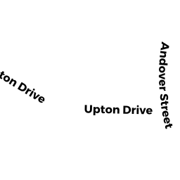
30 UPTON DR
Owner Information
ALBANO STEPHEN A & E JEAN TRS
79 CHESTNUT HILL RD
AMHERST, NH 3031


Property Details
30 UPTON DR is classified as a Warehouses for storage of manufactured products (Light indust).
The primary structure on this property was built in 1989. There are 80,000ft2 of built area within this property. There are 3 units within this property.
30 UPTON DR is valued at $6,243,500. The land is valued at $2,857,300 and the structures are valued at $3,239,000. There is an additional valuation of $147,200 on this property.
This property is in Zone IND. Confirm with local Zoning Board authorities to ensure there are no overlays or other easements on this property.
The most recent deed for 30 UPTON DR is recorded at the local registrar in Book 11758, Page 242. 30 UPTON DR was last sold on Wednesday, June 13, 2001 for $4,875,000.
Assessment data from fiscal year 2021.
Flood Data
According to the FEMA National Flood Hazard Layer, this property does not appear to be in a flood zone. It may also be in an area not yet reviewed. Nonetheless, confirm this information prior to taking any action.
To view the flood hazards around this property, create a FEMA "Firmette" Map of the area around 30 UPTON DR.
Broadband Internet Providers
| Provider | Type | Bandwidth (mbps) | |
|---|---|---|---|
| Broadview Networks Holdings, Inc. | Copper Wire | 0 | 0 |
| CenturyLink | Copper Wire | 0 | 0 |
| GCI Communication Corp. | Satellite | 0 | 0 |
| Viasat Inc | Satellite | 100 | 3 |
| MCI | Copper Wire | 0 | 0 |
| Crown Castle Fiber | Fiber | 0 | 0 |
| HughesNet | Satellite | 25 | 3 |
| VSAT Systems, LLC. | Satellite | 2 | 1 |
| Towerstream | Fixed Wireless | 0 | 0 |
| Verizon New England Inc. | DSL | 15 | 1 |
| Verizon New England Inc. | Fiber | 940 | 880 |
| TPx Communications | Copper Wire | 0 | 0 |
| Comcast | Cable | 1000 | 35 |
| Tailwind Voiceand Data | Cable | 0 | 0 |
| PAETEC Communications, Inc | Fiber | 0 | 0 |
| PAETEC Communications, Inc | DSL | 0 | 0 |
Broadband service provider data from December 2020.
Adjacent Properties
- 28 UPTON DR
Undevelopable Industrial Land owned by UPTON TECH PARK - 181 BALLARDVALE ST
Office Building - part of manufacturing operation owned by G&I IX/GP4 181 BALLARDVALE LLC - 36 UPTON DR
Developable Industrial Land owned by PGA REALTY COMPANY - 251 BALLARDVALE ST
Office Building - part of manufacturing operation owned by CRL HOLDINGS INC - 26 UPTON DR
Warehouses for storage of manufactured products owned by 26 UPTON DR, LLC